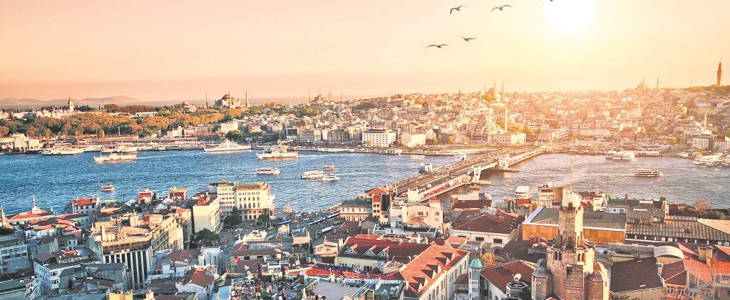
Category: Tourism

  • Disabled Travellers in Turkey

    disabled

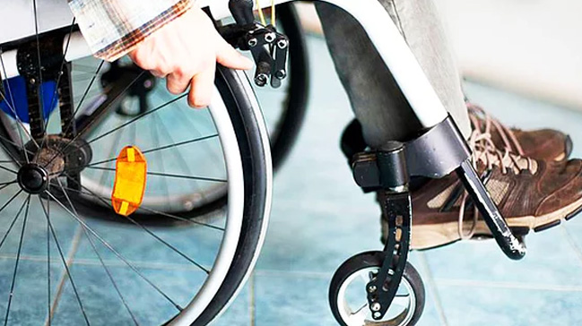
    If you have any queries relating to any-special needs for your holiday, it is best to check direct with us and/ or your tour operator before booking your holiday. The resorts which are located in relatively flat areas and are therefore, better suited to wheelchair users are: Marmaris, Icmeler, Dalyan, Fethiye, Kas Beach, Side. Anyone who has difficulty in walking should certainly avoid resorts on steep hills such as Kalkan and Tuning. Obviously, hotel locations vary so do check before booking.

    Some of the newer and larger hotels have rooms specifically designed for wheelchair users, however, even where hotels do not have specific facilities they will usually try their best to be helpful by, for example, allocating a ground floor room. Many Turkish resorts and cities are not planned for wheelchair access, which can make life difficult, however, you will find that Turks always try their best to be helpful and will gladly improvise to find a solution.

  • A Peninsula On The Marmara Sea Kapidag

    kapidag peninsula turkey

    A PENINSULA ON THE MARMARA SEA KAPIDAG
    The ferry headed out to sea from the quay at the southern mouth of the Bosphorus and picked up speed. Behind us Istanbul became gradually smaller as it receded into the distance, disappearing altogether an hour later. The ship seemed reduced to a tiny speck in the middle of the Marmara Sea. For a long time the gulls swooped alongside, seizing food thrown by the passengers and rising into the air again. No one seemed in a hurry for this pleasant journey to end.

    When the boat reached Bandirma most of the passengers would be heading for the resort of Erdek to spend the weekend in guest houses, hotels or holiday homes, but we planned to skirt the town and explore the lesser known parts of the Kapidag peninsula, visiting all its villages and coves. Four hours later the peninsula appeared as a blurred shape on the horizon, and half an hour later we were entering the Gulf of Bandirma. The delightful voyage was over, and we were soon standing on dry land again.

    Apart from the small town of Erdek there are seventeen villages on the Kapidag peninsula. Our first stop on the Erdek road was the village of Asagi Yapici, situated on the isthmus. After a short break we were off again to Hamamli, a village 9 kilometres from Erdek. The village stands on the acropolis of the ancient city of Kyzikos, and some ruins can still be seen. In the 3rd century BC Kapidag was an island, separated from the mainland by a narrow strait, along which the Argonauts sailed to Kyzikos on their way to find the Golden Fleece.

    From the village of Hamamli we drove to Yukari Yapici, and from there to Kirazli Monastery, 17 kilometres from the main road. The Monastery of Panaghia Theotokos Faneromeni, known as Kirazli Manastiri (Monastery of Cherries) to the locals, was inhabited until 1923. The 90-room building has a church in the courtyard. After wandering around the ruins, we returned to Yukari Yapici. We intended to travel anticlockwise around the peninsula via the village of Ballipinar (alias Kocaburgaz) on the north coast.

    The east-bound road wound through woods of chestnut, hornbeam, beech and oak, and as we drove we looked out for wild birds and animals. The peninsula was declared a wildlife sanctuary in 1978, and hunting is forbidden here, so its forests and hills are home to eagles, hawks, falcons, beavers, martens, wild boars, polecats, foxes, jackals, roe deer, and rabbits. There are also fallow deer, thought to have been introduced here from the Belgrat forests north of Istanbul, and today forming a colony estimated at 70 to 75 in number.

    Passing the seaside villages of Tatlisu and Dalyan on the east coast, with their numerous holiday homes, we arrived at Karsiyaka (Paremo). This large village is home to a community of Pomak Turks who migrated here from Kavala in northern Greece. Here there was a wedding going on, to which we received an invitation. The crowd of guests made a memorable sight, the girls and women dressed in traditional costume consisting of red salvar (baggy trousers), brightly patterned dresses, black coats known as saya, and colourful headscarves.

    kapidag peninsula

    After drinking thirstily from the village fountain, we watched the wedding celebrations for a while and then took our leave. Our next stop was the village of Çakil at the northeast extremity of Kapidag. This village was once inhabited by Greeks from Crete and used to be a busy port of call for shipping, but today it has lost its importance and is a quiet backwater. In the harbour there is a gigantic statue of Atatürk. From Çakil the road turned westwards to Ballipinar, the former Kocaburgaz, which like Karsiyaka is inhabited by Pomaks from Kavala.

    The village is a picturesque place, with narrow paved streets, wooden houses and a ruined church. It is famous for its red onions, producing nearly 2500 tons a year. If you happen to come at the time of the onion harvest, you will find all the villagers sitting in the shade of makeshift arbours along the shore busy braiding the onion stems to form the long bunches which hang to such decorative effect in greengrocers shops.

    On the way to the village of Ormanli we passed onion fields squeezed into the fertile land between small coves. The views were magnificent, with forest clad hills on the one hand and pretty coves on the other, some with tiny villages on the shore. The village of Turan was one such. This area attracts many Turkish holidaymakers, and there are plenty of pensions in the villages of Turan, Doganlar and Ilhanli. From Ilhanli the road turns south along the west side of the peninsula to the village of Narli, beyond which is Ocaklar.

    Both these villages have good asphalt roads and are served by minibuses from Erdek for visitors without their own transport. They offer a choice of accommodation for visitors in reasonably priced and clean pensions. Kapidag is ideal for weekend breaks throughout the year, and its beautiful sand beaches and sea make it equally popular for summer holidays. Exploring this unspoilt area is a delight. Around the coast each bend in the road reveals another lovely cove, and visitors can walk in the footsteps of the Argonauts when they discover the ancient ruins of Kyzikos. Source: Skylife May / 2000
  • Safety in Turkey

    istanbul turkey

    Turkey is one of the safest countries in the world to travel, but some rare instances of theft and robbery happen in big cities. Just leave your valuable stuff, spare money and passport at hotel safety box. Almost every hotel has a safety box service free to hotel customers which you are strongly urged to use. Please take great care with your passport, airline tickets and monies.

    Do not carry more cash than required. A money belt worn under your clothing is suggested. If you are buying something, you should not flash large amounts of money around. Please clearly mark all your baggage with your name and address. Common sense and awareness will greatly reduce the unlikely misfortune of loss or theft. We also suggest you carry small padlocks for your luggage.

  • The Sea of Marmara, Turkey

    Known as the Sea of Marmora or the Marmara Sea, is the inland sea that connects the Black Sea to the Aegean Sea, thus separating Turkey’s Asian and European parts. The Bosporus strait connects it to the Black Sea and the Dardanelles strait to the Aegean. The former also separates Istanbul into its Asian side and European side. The Sea has an area of 11,350 km² (280km x 80km) with the greatest depth reaching 1 370 m.

    The salinity of the sea averages about 22 parts per thousand, which is slightly greater than that of the Black Sea but only about two thirds that of most oceans. However, the water is much more saline at the sea-bottom, averaging salinities of around 38 parts per thousand — similar to that of the Mediterranean Sea. This high density saline water, like that of the Black Sea itself, does not migrate to the surface. Water from the Granicus, Susurluk, Biga and Gonen Rivers also reduces the salinity of the sea, though with less influence than on the Black Sea.

    With little land in Thrace draining southward, almost all of these rivers flow from Anatolia. There are two major island groups known as the Prince’s and Marmara islands. The latter group is rich in sources of marble and gives the sea its name (Greek marmaro, marble). Alternatively, the name may come from the Indo European, compare Hittite marmar(r)a, from mori ‘inland body of water’. The North Anatolian fault, which has triggered many major earthquakes in recent years, such as the Izmit Earthquake of 1999, runs under the sea.

    The sea’s ancient Greek name Propontis derives from pro (before) and pont (sea), deriving from the fact that the Greeks sailed through it to reach the Black Sea. In Greek mythology, a storm on Propontis brought the Argonauts back to an island they had left, precipitating a battle where either Jason or Heracles killed King Cyzicus, who mistook them for his Pelasgian enemies.

  • Turkey’s Coastlines

    Turkey is surrounded by sea on three sides, by the Black Sea in the north, the Mediterranean in the south and the Aegean Sea in the west. In the northwest there is also an important internal sea, the Sea of Marmara, between the straits of the Dardanelles and the Bosphorus, important waterways that connect the Black Sea with the rest of the world. Because the mountains in the Black Sea region run parallel to the coastline, the coasts are fairly smooth, without many indentations or projections.

    The length of the Black Sea coastline in Turkey is 1,595 kilometers, and the salinity of the sea is 17 percent. The Mediterranean coastline runs for 1,577 kilometers and here too the mountain ranges are parallel to the coastline. The salinity level of the Mediterranean is about double that of the Black Sea.

    Although the Aegean coastline is a continuation of the Mediterranean coast, it is quite irregular because the mountains in the area fall perpendicularly into the Aegean Sea coast is over 2,800 kilometers. The coastline faces out to many islands. The Marmara Sea is located totally within national boundaries and occupies an area of 11,350 square kilometers. The coastline of the Marmara Sea is over 1,000 kilometers long; it is connected to the Black Sea by the Bosphorus and with the Aegean by the Dardanelles.