Located in the southern part of the Marmara Region, Karacabey is one of the largest districts of Bursa Province, covering an area of approximately 1,247 square kilometres. Thanks to its fertile plains, rich wetlands, and strategic location, Karacabey has long been one of Türkiye’s most important agricultural and natural areas.
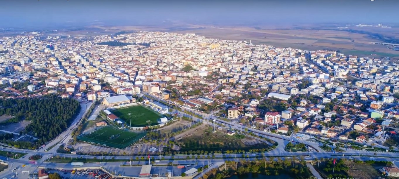
The district lies at the junction of the Bursa–Çanakkale, Bursa–Balıkesir, and İzmir highways, making it an important transportation hub in northwestern Türkiye. Karacabey is bordered by Mudanya and central Bursa to the east, Mustafakemalpaşa and Susurluk to the south, Manyas to the southwest, Bandırma to the west, and the Sea of Marmara to the north.
History
The history of Karacabey stretches back more than 3,000 years. Archaeological evidence indicates that settlements existed here as early as the 12th century BC, when the Mysians inhabited the region. During antiquity, the ancient city of Miletopolis stood within the present-day district.
Throughout its long history, the region came under the rule of numerous civilizations, including the Phrygians, Lydians, Persians, the empire of Alexander the Great, the Kingdom of Pergamon, and the Romans. During the Byzantine period, the settlement became known as Mihaliç, a name it retained for centuries.
In 1336, shortly after the Ottoman conquest of nearby Uluabat (Lopadion), the local Byzantine rulers pledged their allegiance to Orhan Gazi, and the district peacefully became part of the growing Ottoman state.
Following nearly six centuries of Ottoman rule, Karacabey was occupied by Greek forces on 6 July 1920 during the Turkish War of Independence. The town was liberated on 14 September 1922, when Turkish forces regained control.
Historical Attractions
Karacabey preserves several significant monuments from the Ottoman period, including:
- Great Mosque (Ulu Camii), commissioned by Sultan Murad I.
- Karacabey (İmaret) Mosque, built by Karaca Bey in 1457.
- Issız Han, a beautifully preserved Ottoman caravanserai located on the historic Bursa–Karacabey trade route near Uluabat Lake.
These monuments reflect the district’s importance as a commercial and cultural center throughout the Ottoman era.
Geography
Karacabey occupies one of the most fertile plains in the Marmara Region. The Karacabey Plain was formed during geological movements in the Quaternary Period, creating a broad alluvial basin surrounded by lakes and gentle hills. The district itself sits at an average elevation of only 24 metres above sea level.
The plain is bordered by Uluabat Lake to the east and Manyas (Bird) Lake to the west. To the north, the coastline along the Sea of Marmara features rugged cliffs, small crescent-shaped bays, sandy beaches, and wetlands.
East of Yeniköy, where the Kocadere River reaches the sea, a small delta has formed. This delta contains two coastal lagoon lakes—Arap Çiftliği Lake and Dalyan Lake—which provide important habitats for wildlife and migratory birds.
Karadağ (Black Mountain)
The district’s highest landform is Karadağ, whose highest peak, Sarnıç Tepe, rises to 764 metres above sea level. The mountain is separated from the Mudanya Hills by the Susurluk River valley and is covered with forests that contrast sharply with the surrounding plains.
Rivers
Several rivers cross the district, enriching its fertile agricultural lands.
Susurluk River
The Susurluk River originates in the Şaphane Mountains under the name Simav Stream. After flowing through Lake Simav, it becomes the Susurluk River and crosses the Karacabey Plain. It is joined by the Nilüfer Stream from the east and the Karadere from the west before reaching the Sea of Marmara, where it forms a broad delta. The river is approximately 321 kilometres long.
Nilüfer Stream
Fed by numerous streams descending from Uludağ, the Nilüfer Stream supplies water to the Doğancı Dam, one of Bursa’s primary drinking water sources. After crossing the Bursa Plain, it flows westward and joins the Susurluk River.
Karadere
The Karadere River also rises near the Şaphane Mountains before passing through Lake Manyas. It meanders across the Karacabey Plain before merging with the Susurluk River. The river has a length of approximately 160 kilometres.
Additional waterways, including the Mustafakemalpaşa and Orhaneli streams, flow into Uluabat Lake, whose outlet reaches the Susurluk River through Uluabat Stream.
Uluabat Lake
One of the district’s greatest natural treasures is Uluabat Lake (historically known as Lake Apolyont). Covering approximately 134 square kilometres, the lake is relatively shallow, with depths rarely exceeding 1–2 metres.
The lake supports a rich ecosystem of wetlands, reed beds, fish, and migratory birds. Although it was once famous for its abundant crayfish population, overfishing and pollution have significantly reduced aquatic biodiversity in recent decades. During the summer months, falling water levels expose fertile land that is often used for agriculture.
To support irrigation, several reservoirs—including Keşlik, Dağkadı, Bayramdere, and İnkaya ponds—have been constructed in recent years.
Climate
Karacabey experiences a transitional climate between the Mediterranean and Black Sea climatic zones.
Summers are generally warm and dry but less intensely hot than along the Mediterranean coast. Winters are mild, cool, and rainy, with snowfall occurring only occasionally.
The district has an average annual temperature of approximately 14°C, while summer temperatures can reach 38.5°C. Winter temperatures occasionally fall to around –10°C. Average annual rainfall is approximately 562 mm, with most precipitation occurring during the winter and spring months.
Flora and Natural Environment
Karacabey’s vegetation reflects the ecological diversity of the Marmara Region.
The coastal zone supports Mediterranean vegetation, including olive trees, laurel, broom, holm oak, and various drought-resistant shrubs. Areas closer to the sea also provide suitable conditions for some citrus varieties.
The higher elevations of Karadağ are covered with mixed forests dominated by oak, beech, and linden trees. These woodlands provide important habitats for wildlife and contribute to the district’s rich biodiversity.
The rural slopes known locally as Pistikoz are notable for their distinctive vegetation, particularly extensive growths of blackthorn, which thrive in the rocky terrain.
Why Visit Karacabey?
Karacabey offers visitors a unique combination of history, fertile countryside, wetlands, forests, lakes, and coastal landscapes. Whether exploring Ottoman monuments, birdwatching around Uluabat Lake, hiking in Karadağ, or enjoying the peaceful shores of the Sea of Marmara, the district provides an authentic experience of rural northwestern Türkiye.
Often overlooked by international visitors, Karacabey is a rewarding destination for nature lovers, photographers, history enthusiasts, and anyone wishing to discover one of Bursa Province’s hidden gems.